GIS Day: Seeing the Bigger Picture

Every place tells a story, and GIS helps us see the connections that might otherwise be missed.
GIS, or Geographic Information Systems, allows us to collect, layer, analyze, and visualize information tied to a place. For SE Group’s work, that might mean looking at recreation assets alongside trail networks, land ownership, natural resources, visitor use, access, infrastructure, or community input. Bringing those layers together helps our teams better understand existing conditions, identify patterns and opportunities, evaluate alternatives, and communicate complex information throughout the planning process.
This GIS Day, we’re celebrating the role GIS, mapping, and cartography play across our work and the expertise of our Geospatial & Visual Communications Specialist, Aly Ollivierre. Aly brings more than 15 years of experience at the intersection of science, technology, and design. She specializes in translating complex geospatial information into clear, engaging visuals that help people understand places, ask better questions, and make informed decisions.
Before joining SE Group, Aly spent nearly a decade creating Trails Illustrated maps at National Geographic, contributing to topographic map guides for outdoor recreation, from day hikes in National Parks to long-distance trails like the Pacific Crest Trail. Her broader portfolio spans outdoor recreation, conservation, public lands, and community-focused mapping, grounded in both geospatial analysis and visual communication. Her work has earned recognition across the geospatial and cartographic industries, reflecting her ability to pair technical expertise with thoughtful design and compelling visual storytelling.
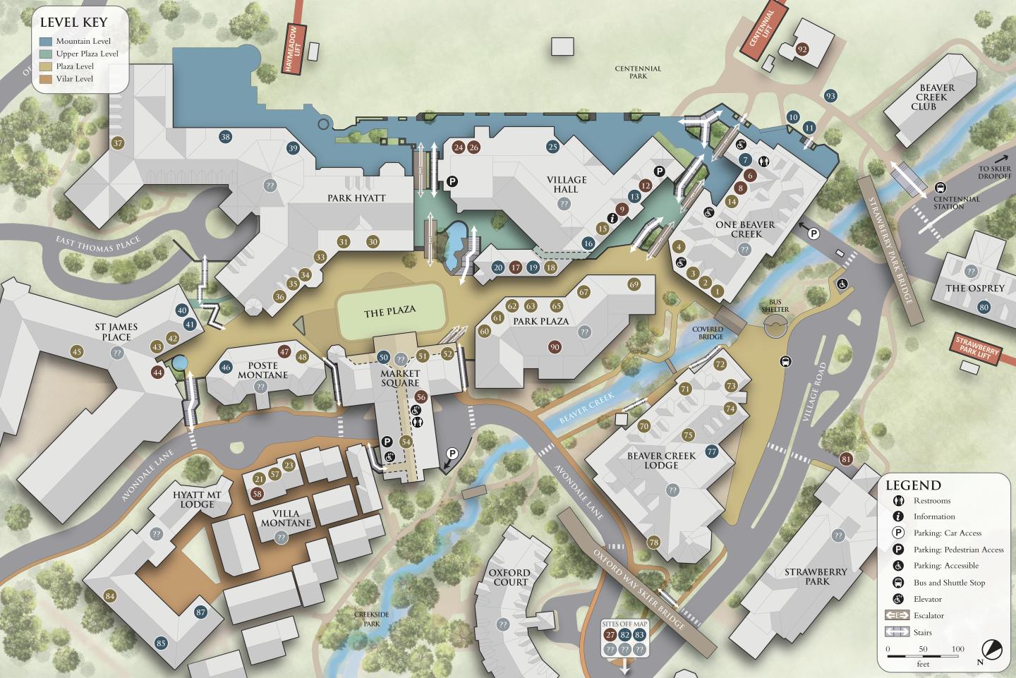
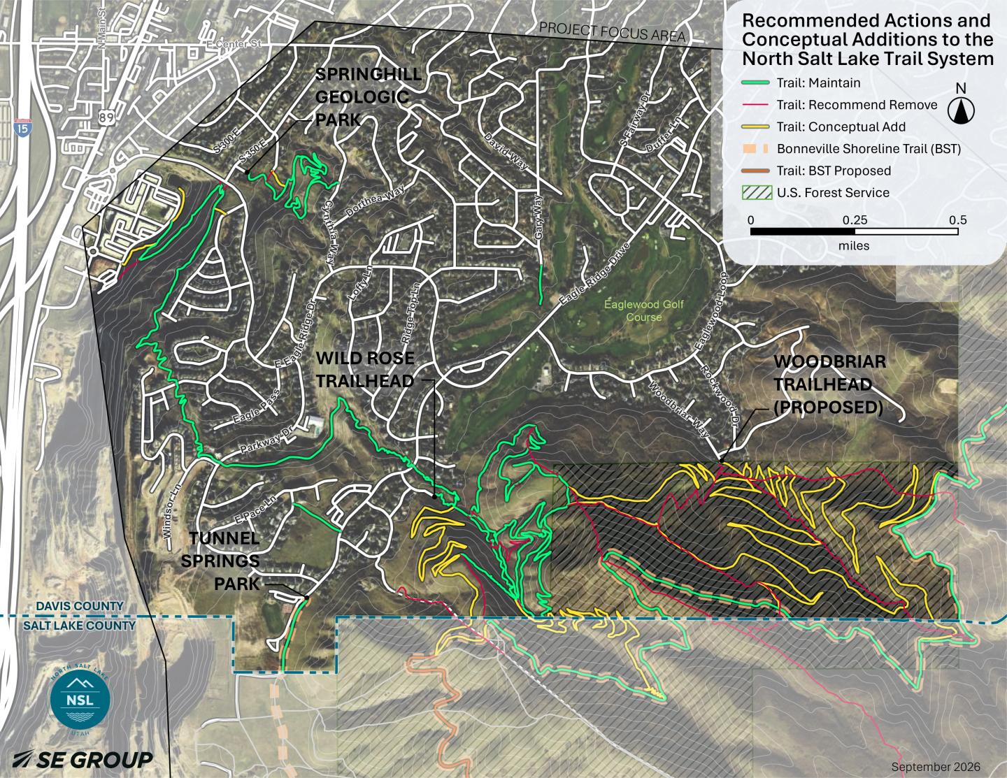
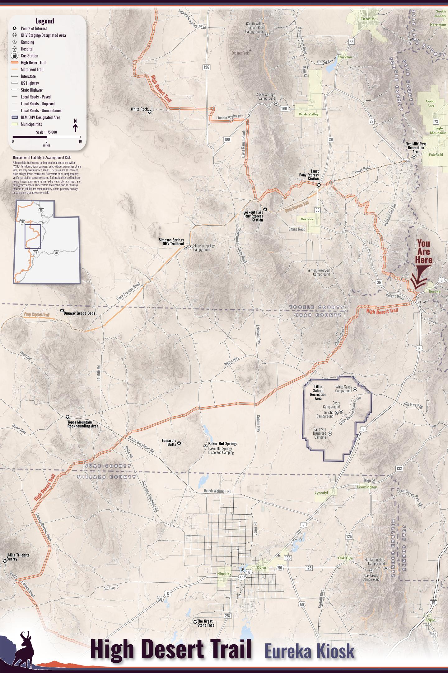
Today, Aly applies that experience across SE Group projects, including recreation planning and spatial analysis to wayfinding and public-facing communications. For the North Salt Lake Trails Master Plan, GIS and cartography helped the team understand a complex network of formal and informal trails and translate analysis, field assessments, and community input into clear recommendations for future connections, trail management, and wayfinding. For Utah’s High Desert Trail, Aly has designed maps for custom kiosks and signage that will help recreationists navigate and understand the statewide route. At Beaver Creek Resort, mapping serves another purpose: creating the spatial foundation for a new wayfinding system designed to help guests navigate destinations and decision points throughout the resort. You can see maps from these projects below!
Across these projects, maps do more than illustrate a final plan; they help us understand places, engage communities, uncover connections, and make better-informed decisions along the way.
On GIS Day, we’re celebrating Aly Ollivierre and the power of GIS and cartography to help our teams, clients, and communities see places in new ways.
Happy GIS Day!
Map highlighting the Recommended Actions and Conceptual Additions to the North Salt Lake Trail System
Trail Map for the Eureka trailhead kiosk for Utah’s High Desert Trail
Wayfinding map for Beaver Creek Resort